Many first-time visitors treat Valle de la Luna as a dramatic half-day excursion near San Pedro de Atacama and stop there. That description is not wrong, but it is incomplete. The valley is not managed like a generic open scenic area. It is Sector 6 of Reserva Nacional Los Flamencos, inside a protected desert landscape where visitor access, local guidance, and conduct rules sit inside a co-management model involving Lickanantay communities and CONAF. Understanding that structure makes the trip easier to plan and much easier to interpret honestly.
This matters because co-management is not an abstract policy hidden in a report. It affects the ticket channel you use, the fact that some sectors are entered through community-managed systems, the instruction to respect local guides and marked routes, and the warning that some traditional or ancestral sectors are not open for general tourism. It also explains why the safest and most respectful visit starts with official notices, current sector rules, and a willingness to stay inside the visitor framework instead of improvising from photos.
Continue with: Valle de la Luna access and ticket guide, Atacama safety and packing advice, complete Valle de la Luna planning guide, lighter-impact travel habits for the valley.
Start with what co-management means here
The basic frame comes from CONAF. Its current Reserva Nacional Los Flamencos page states that the reserve covers 73,986.50 hectares in the commune of San Pedro de Atacama and was created on October 17, 1990 by Supreme Decree 50 of the Ministry of Agriculture. That same page also says the reserve is a unit co-managed with Lickanantay communities, and it places Valle de la Luna inside Sector 6. This is useful because it tells readers immediately that the valley is not a free-standing private attraction and not an anonymous stop on Route 23. It belongs to a wider protected landscape with conservation, visitor-use, and community-management layers all at once.
The current Valle de la Luna operator site adds the second half of the picture. On its homepage, the operator identifies itself as the Asociacion Indigena Valle de la Luna. The same site welcomes visitors to a territory rather than to a simple viewpoint circuit, describes the valley through the Cordillera de la Sal and its long geological formation, and places visitor rules alongside that framing. Even before you reach the ticket page, you are being told that the visit sits inside a lived and interpreted territory, not just a photogenic backdrop.
CONAF's October 8, 2025 article about native flora and Lickanantay knowledge clarifies the broader scale of this model. It states that eight Lickanantay communities manage different sectors of the reserve in associativity, and it specifically lists Valle de la Luna among the sectors involved. The article describes this as an intercultural management model strengthened through more than a decade of collaboration between CONAF and CONADI. For visitors, that means the local community role is not incidental or symbolic. It is part of how public use, interpretation, and conservation are organized.
Why this matters before you book
A traveler who understands the management model asks better questions. Instead of starting with whether sunset will be pretty, they start with which official channel is current, who is guiding public use in that sector, and whether the itinerary respects the site structure.
- Valle de la Luna is part of a reserve, not an isolated roadside stop.
- The operator identifies the valley site through the Asociacion Indigena Valle de la Luna.
- CONAF describes the reserve as co-managed with Lickanantay communities.
Co-management shows up first in tickets, guides, and access rules
The practical evidence is visible in the current visit instructions. CONAF says Valle de la Luna tickets should be purchased at least one day in advance through valledelaluna.com. The same page lists current reference prices of CLP 10,800 general and CLP 5,400 reduced for older adults and students, while making clear that the visitor should review the active platform before traveling. The official Valle de la Luna site separately states seasonal entry windows for bicycles and motorized visitors, and both sources emphasize that people cannot enter the main site on foot. That combination of ticket platform, controlled time slots, and specific entry modes is a management system, not a casual drop-in experience.
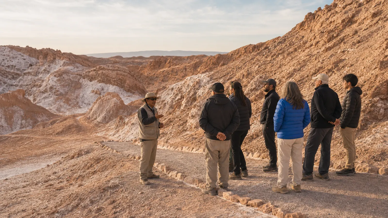
Guides are also part of the structure. CONAF tells visitors to respect the instructions of park rangers and Atacameno guides working inside the sectors. The Valle de la Luna operator site similarly includes following the local guide among the core visitor agreements. These are not decorative recommendations. They tell you who mediates the visitor experience once you are inside: staff and local guides help regulate the route, pace, safety, and interpretation of a fragile landscape that does not function well under improvised mass movement.
This becomes more important when conditions shift. Seasonal schedules differ between April to August and September to March. Trail exposure can change with wind or rain. Specific sectors may follow their own hours. When visitors rely on a co-managed site, the practical discipline is simple: use the current official channel, arrive with margin, and accept that the route of the day is shaped by the active rules rather than by the version you saw on an old itinerary post.
Use official channels as operating channels
The ticket page is not just a place to pay. It is part of the management interface. The same applies to the reserve page, where current rules, closures, risks, and conduct expectations are published.
- Buy through the current official system and re-check the active conditions.
- Treat the entry window as a real operating rule, not a suggestion.
- Expect local guidance to shape what a reasonable route looks like that day.
- CONAF currently advises buying Valle de la Luna tickets at least one day in advance.
- The reserve guidance and operator site both say the main site cannot be entered on foot.
- Seasonal windows differ for bicycles and motorized visitors and should be re-checked on the day.
Visitor framework
How to plan Valle de la Luna through co-management
Use the official management structure as your planning sequence instead of treating the valley like an open scenic stop.
Confirm
Read the current Valle de la Luna and CONAF notices before you book or depart.
Respect
Assume marked routes, guides, and sector limits are part of the visit itself.
Adapt
Let active rules, conditions, and group pace reduce the route if needed.
Interpret
Treat the valley as a protected and culturally situated territory, not only as a photo stop.
Protected tourism zones are not the whole territory
One of the clearest reasons to explain co-management is that it changes how visitors should interpret open space. CONAF's reserve page tells travelers to prefer sites enabled for tourism because it is easy to get lost or to reach traditional and ancestral sectors of the communities that are not enabled for visitation. This single sentence is more important than many generic responsible-travel slogans. It explains that the reserve contains more than scenic points for outside consumption. Some areas remain part of living community space, and the visitor's right to move does not expand just because the desert looks empty.
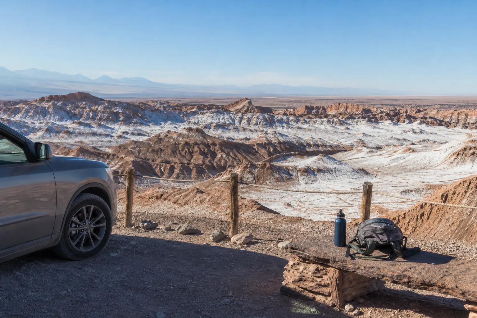
That has direct consequences for behavior inside Valle de la Luna. Staying on marked routes is not only an erosion precaution. It is also a boundary practice. The official Valle de la Luna page tells visitors to respect natural and cultural heritage, walk only on delimited and marked paths, avoid collecting rocks or salts, keep vehicle speed low, and avoid pets, alcohol, and drones. CONAF adds wider reserve prohibitions: no littering, no leaving trails, no feeding wildlife, no disruptive noise, and no unauthorized drone use. The rule set makes more sense when you read it through co-management. It protects formations, wildlife, visitor safety, and community space at the same time.
This is also where a lot of weak travel content fails. It often treats empty desert as if it were ownerless and infinitely available. The official sources do not support that reading. They describe a managed and culturally situated territory. For a reader, the useful conclusion is concrete: do not mistake low density for free access. If a turnoff, ridge, or apparent shortcut is not part of the enabled visitor route, it is not yours to normalize in a photo or in a family outing plan.
Marked routes are interpretation tools too
The route is not just a safety corridor. It is also the way the site chooses to show the place. What you see, in what order, and with which restrictions is part of how the landscape is presented to the public.
- Do not follow other visitors beyond a boundary because the desert looks open.
- Do not use a dramatic photo angle as a reason to leave the visitor route.
- Treat non-enabled space as off-limits even if there is no crowd nearby.
Interpretation, conservation, and accessibility are built into the model
Official sources also show that co-management is not limited to entry control. CONAF's May 10, 2024 article on inclusive visits in Reserva Nacional Los Flamencos describes an accessibility project that included Valle de la Luna, Aldea de Tulor, Chaxas, and Miscanti and Miniques. The article says these sectors are co-managed between CONAF and Lickanantay communities, naming the Asociacion Indigena Valle de la Luna for the valley and the communities of Coyo, Toconao, and Socaire for other sectors. It also explains that the project included local-manager training, tactile maps, audiodescriptive videos, and the support of local Lickanantay guides. That matters because it shows the model creating practical visitor tools, not just governance language.
The October 2025 CONAF article on native flora and Lickanantay knowledge pushes the same point further. It describes a field guide meant to combine scientific information with ancestral knowledge and to strengthen environmental education inside the reserve. The article explicitly says the updated guide helps Indigenous guides working every day in the reserve provide accurate scientific and traditional-use information so that visitors receive reliable knowledge from a first source. That is a strong editorial signal. The visitor experience is meant to include interpretation grounded both in conservation science and in local knowledge, not just scenic admiration.
For travelers, this changes the value of slowing down. A co-managed visit is not only about getting compliant access and then rushing toward a sunset frame. It is a chance to read why rules exist, why some sectors are more tightly regulated than others, and why a guide's explanation may be central rather than optional. The valley remains visually extraordinary, but the official material suggests that its public meaning is also educational and intercultural.
Why this is useful for families and first-time visitors
People who arrive with little desert experience often need more than distances and opening hours. They need a structure that explains what matters, what is fragile, and how not to misread the place. Co-management makes that structure visible.
- Local guides are part of interpretation, not just crowd control.
- Accessibility work shows the model can widen public use without pretending every terrain limit disappears.
- Educational framing helps children and first-time visitors understand why rules are non-negotiable.
Plan your half-day around the management model, not around social media habits
Chile Travel's current Valle de la Luna page gives useful logistics: the site is about 15 kilometers from San Pedro de Atacama on Route 23, or roughly 13 kilometers depending on how the approach is described, with a short car trip or a longer bicycle approach. It also tells visitors to bring water, sun protection, and to verify the last entry time. Those are practical basics, but they become more meaningful when combined with the co-management sources. A short distance does not make the visit casual. The closer the site feels, the easier it is to underestimate its operating rules and cultural boundaries.
A better half-day plan starts with the reserve and operator channels, then with transport, then with group profile. If your group includes older adults, children, or anyone with reduced tolerance for exposure, use the current rules to narrow the day to one or two meaningful stops rather than chasing every named viewpoint. If a special notice changes a sector or an hour, adapt immediately instead of treating the rule as friction. That is what a respectful visitor looks like inside a co-managed protected landscape: someone whose plan can shrink without becoming chaotic.
This is also the right place to be conservative with prices, timing, and route certainty. CONAF currently displays reference pricing and seasonal windows, but those details can change. The operator site can publish special notices or system changes. A serious article should therefore give readers a planning method rather than a false promise. Check the latest notice, buy through the current channel, keep a buffer before the last entry, and assume that the experience is strongest when it stays inside the route that the day actually allows.
What a co-management-aware plan looks like
The point is not to become formal or rigid. It is to make your plan resilient enough that the official rules and local guidance can still lead the day.
- Check the reserve page and the operator page before leaving San Pedro.
- Choose transport that fits the active access mode and the group's stamina.
- Keep one stop as the priority and let the rest stay optional.
Questions worth asking on the day of your visit
Because co-management is visible at several layers, good visitor questions are usually simple and respectful. Ask which sectors are open today, whether any trail conditions have changed, what time you realistically need to begin returning, and whether there are any accessibility or pacing considerations for your group. If a local guide or ranger advises shortening the stop, treat that as part of the experience rather than as a loss. The official sources already tell you that climate, season, and local operations can change the day.
It is also worth asking yourself what kind of story you want to take away. If the goal is only to prove you reached a famous viewpoint, you may resist exactly the limits that protect the place. If the goal is to understand how a protected landscape is being visited responsibly, the same limits become meaningful. You start noticing why marked paths matter, why there is value in quiet, why unauthorized drones are not compatible with the space, and why local guidance should not be edited out of the narrative.
The strongest final habit is to leave the valley without normalizing behavior the official sources reject. Do not encourage off-trail shortcuts in captions, do not make it seem that boundaries are optional, and do not present community-managed rules as annoying obstacles. A better reading is more accurate: those rules are part of how Valle de la Luna remains visitable at all.
A day-of checklist that respects the model
If this short list is clear before departure, the visit usually becomes simpler, safer, and more honest.
- Official operator and CONAF notices checked today.
- Ticket, access mode, and last-entry timing confirmed.
- Group pace matched to the least tolerant member, not the fastest one.
- No plan to leave marked routes, fly a drone, or improvise in non-enabled sectors.
- Which sectors are open and realistically comfortable today?
- Which stop matters most if the route needs to be shortened?
- Is there any current notice affecting your chosen schedule or access mode?
- What local guidance should your group follow once inside?
A better visit starts before the entrance gate
Understanding Lickanantay co-management does not make a Valle de la Luna trip heavier or more complicated. It usually does the opposite. It tells you which channels matter, why marked routes and local guidance are central, why some empty-looking areas are not visitor space, and why ticketing and timing should be read as site protection tools rather than as inconvenience.
That perspective also improves the quality of the visit. Instead of trying to win against the rules, you start reading the place through them. You see a protected landscape that remains open because its public use is organized carefully, with community involvement, conservation constraints, and day-of operational checks. That is a more accurate and more respectful way to travel through Valle de la Luna.
Frequently asked questions
Does co-management mean Valle de la Luna is privately owned by one community?
No. The official sources describe Valle de la Luna as part of Reserva Nacional Los Flamencos and explain that the reserve includes sectors co-managed between CONAF and Lickanantay communities. For visitors, the practical point is not ownership theory but understanding that access, guidance, and public use are organized through a shared management model.
Why do local guides matter if I already know the route?
Because the official reserve guidance and the operator site both place local guides inside the visitor rule system. They help interpret the place, regulate movement, and keep the visit inside the sectors and conditions that are actually open that day.
Can I explore beyond the marked route if the desert looks empty?
No. CONAF explicitly advises visitors to stay in sites enabled for tourism and warns that traditional and ancestral community sectors may not be habilitated for visitation. The official visitor rules also require staying on marked paths.
Are ticket prices and opening hours fixed all year?
No. CONAF currently shows reference prices and seasonal schedules, and the operator site lists active hours, but both should be checked again on the day of travel because conditions and notices can change.
How does co-management change the visitor experience in practice?
It changes where you buy tickets, how you interpret local guidance, why sector rules matter, how you think about off-limit space, and how you understand conservation and accessibility work inside the reserve. The valley becomes more than a viewpoint circuit once you read those layers together.
Sources and editorial caution
- Valle de la Luna official site and visitor agreements — Valle de la Luna
- Reserva Nacional Los Flamencos visitor information — CONAF
- Rescatan flora nativa y saberes Lickanantay en nueva guia del Desierto de Atacama — CONAF
- Inician visitas inclusivas en la Reserva Nacional Los Flamencos — CONAF
- Valle de la Luna (Moon Valley) — Chile Travel